

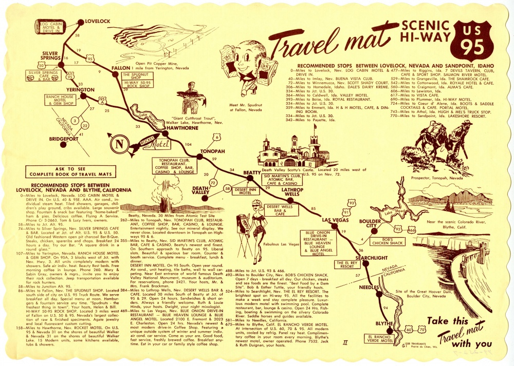
The Travel Mat for US 95 shows tourist attractions from Lovelock, Nevada to Blythe, California, featuring the Nevada Test Site and Boulder Dam, approximately 1940-1970, UNLV University Libraries Menu Collection, MS-00436
In today’s age of Google maps, Yelp, and the multitude of smartphone apps available for travel and leisure, taking a road trip is somewhat different from the post-World War II era, when long-distance car travel was a momentous occasion. The post-war economic boom of the 1940s and 1950s meant more people could afford cars, and this, along with more employers offering paid vacation time, meant that road trips were a popular family activity.
This summer, I had the opportunity to work as an archival processing assistant in the UNLV Libraries Special Collections and Archives Division. Our team has been processing the UNLV University Libraries Menu Collection (MS-00436). Included in this collection are menus and other dining materials from all over the world, and the items that most interested me were these placemats from another era. Travel Mats were placemats used in restaurants along United States highways that outlined the route of the highway, along with places of interest along the route, such as restaurants, motels, and roadside attractions. They used a map format, along with information on mileage between cities.
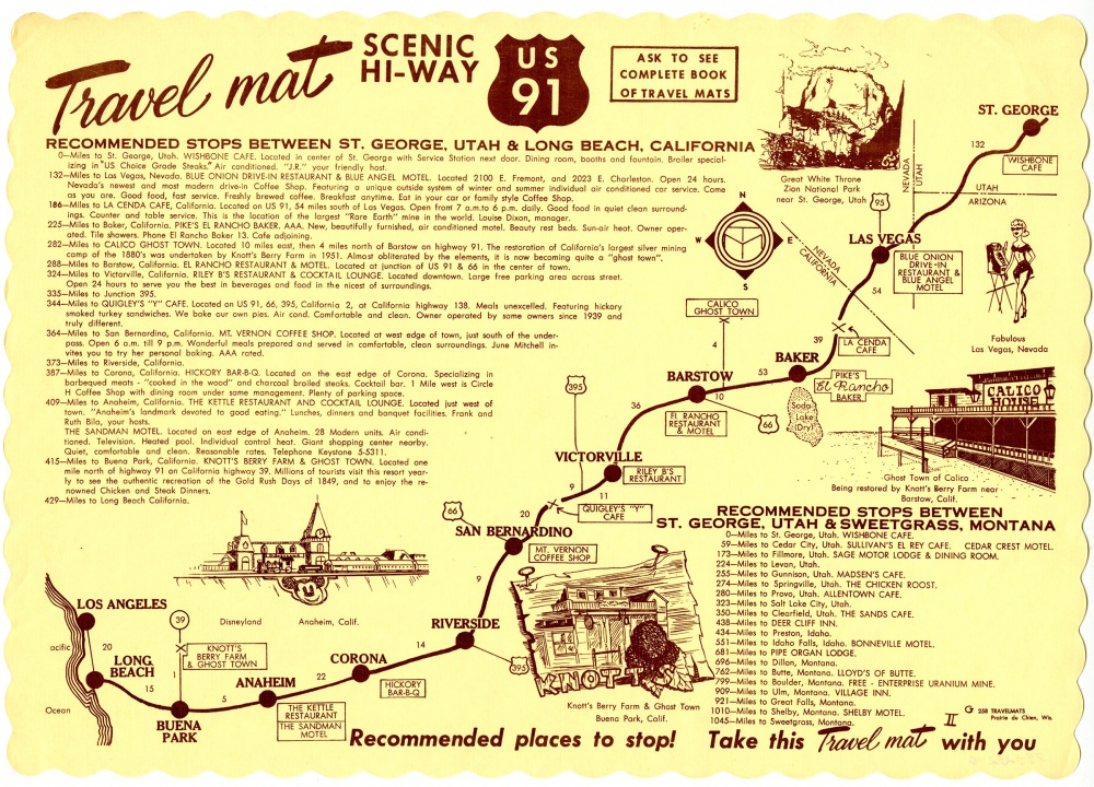
Landmarks featured on the Travel Mat for US 91 include Disneyland and Zion National Park. The placemat details the route between Los Angeles, California, and St. George, Utah, approximately 1940-1970, UNLV University Libraries Menu Collection, MS-00436
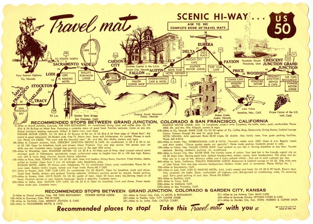
These mats usually highlighted regional sections of highways. For example, US 50 runs east-west from Maryland to California, but this Travel Mat shows attractions stretching from Grand Junction, Colorado to San Francisco, California. United States highways were the main north-south and east-west arteries that ran through the country before the development of the interstate system in 1956. Interstates promoted controlled-access travel, meaning drivers could only enter and exit the road through designated on and off-ramps. Highways were more leisurely and let travelers see more of the towns and cities they passed through.
The Travel Mat for US 50 shows stops along the east-west route from Grand Junction, Colorado to San Francisco, California. Many small Nevada towns, such as Ely and Fallon, are pointed out, approximately 1940-1970, UNLV University Libraries Menu Collection, MS-00436
There isn’t much information available on the history of Travel Mats, so it is unclear how the company chose to include businesses and attractions--whether businesses paid to be featured, or if the writers simply showcased what they believed to be the best restaurants, cafes, and motels. Either way, these artifacts remind us of the golden age of American road trips.
The menu project was supported by funds from Mark and Marianne Haley and the UNLV University Libraries Advisory Board.